|
|
|
|
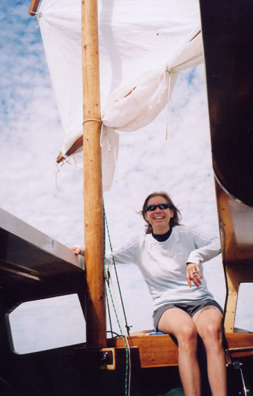
Arcebus Home
|
Anyone interested in a multi-boat excursion through Minnesota's
gorgeous Voyageurs National Park? I've gone cruising around up there five times now
and think it would be fun to share the experience with a fleet of other small boats.
I'm not sure what the ideal number of boats would be -- maybe five? more?. The biggest
limiting factor would be finding campsites that aren't too spread out. The largest sites can
accommodate up to 18 people (although space for boat tie-ups varies).
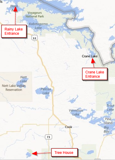
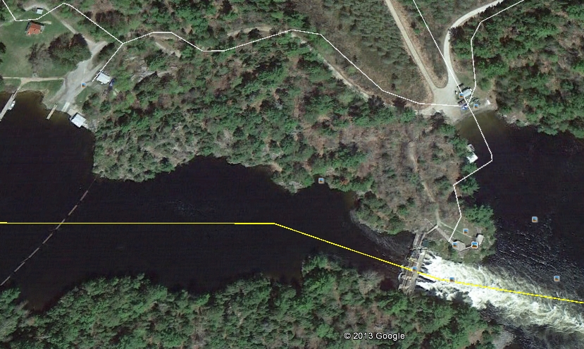
I'm suggesting doing it in May because there are plenty of sites to choose from and the bugs are light to non-existent. You run a risk with the weather, but I've gone twice before in May and had great experiences both times. The type of boat that could make this trip would be seaworthy and dry (the water will be cold), capable of handling considerable wind and waves, but small enough to use the portage service at Kettle Falls.* The boat should be equipped with an outboard motor and be capable of going 4-5 MPH. I primarily have sailboats in mind, but there is no reason to exclude a power boat that is willing to travel at displacement speed. I put together a possible itinerary below. I've never done the Rainy Lake part -- if people would prefer a shorter trip on more sheltered waters, an alternative would be to go from the Ash River entry (on the southeastern shore of Kabetogama) to the Crane Lake entry. Either way, the prevailing wind would be with us. This would not a competitive event -- just a chance for people to enjoy the company of fellow sailors on an adventurous and beautiful trip. If you (and crew) are interested in participating, please e-mail Greg Lindberg, lindburly@comcast.net. *The portage service can accommodate boats up to 23' long, 8' wide, and 5,000 lbs. They use an 18" wide strap to cradle the back of the boat and the front of the boat rests on a flatbed. The charge is $20. Itinerary
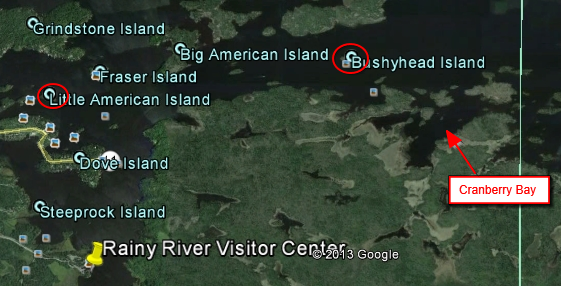
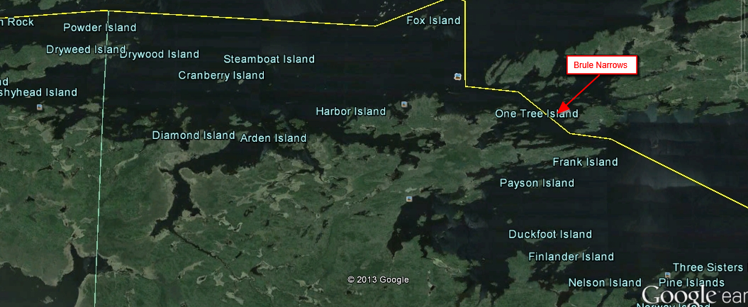
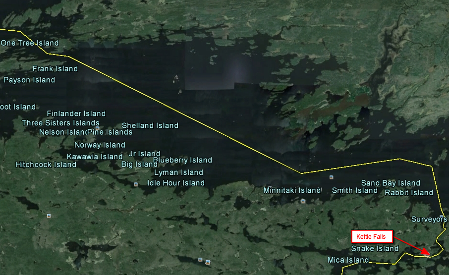
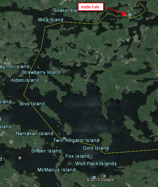
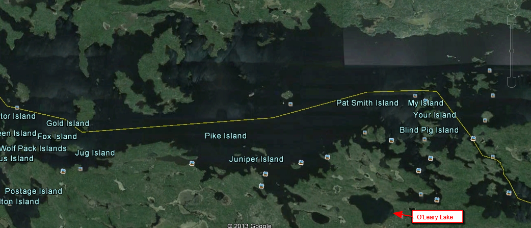
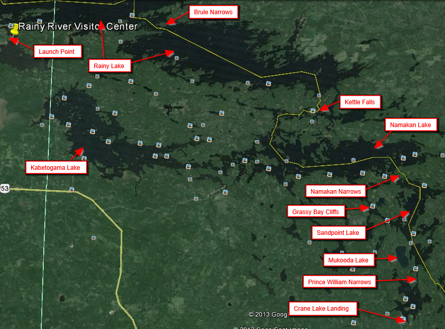
To put things in perspective, here is the whole trip. Except for the very
last part, it follows the U.S. / Canada border.
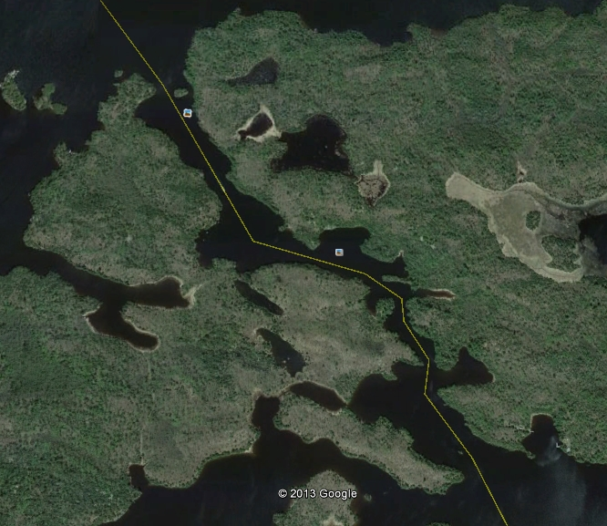
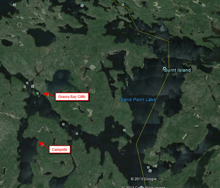
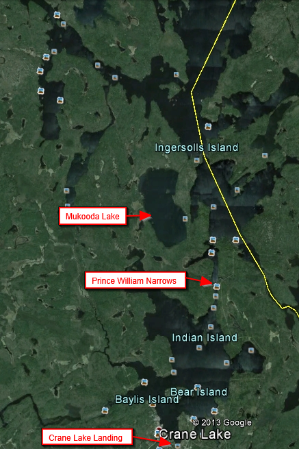
There are some sandy beaches, but unforgiving 3-4 billion year old solid-rock and boulder shorelines prevail. A Rainy Lake guide once said that there are two kinds of boats in Rainy Lake: those that have hit rocks and those that will hit rocks. In my experience, the rocks and reefs are fairly well marked because of the amount of houseboat and power boat traffic in the area, but careful navigation is a must. It is possible, particularly on Rainy Lake, that we may have to hunker down for a time if the wind blows hard, but there are plenty of lee shores for shelter. There are two different kinds of campsites in the area: houseboat sites and tent-camp sites. The tent sites may be used if at least some campers are sleeping in a tent. If all sleep in the boat, you are supposed to use a houseboat site. Small tent sites have two tent pads and a maximum of 9 campers. Large tent sites have four tent pads and a maximum of 18 campers. All sites have pit toilets and bear lockers. Boat accommodations vary -- some sites have docks, some have a log wall to tie up to and some have beaches. Some sites can accommodate only one boat and some can accommodate several. All sites are available on a first-come basis and there are no camping fees (finding campsites will not be a problem this time of year). Whether you'll want to anchor out depends on the lake bottom and the amount of shelter from the wind. In most areas, the bottom is solid rock/boulders and may not hold your anchor. The average temperatures for May are 65 for the high and 40 for the low, but they are extremely variable. The prevailing wind is from the Northwest, and May was the windiest month of the year last year. Here is a very informative overview of Voyageurs National Park with pictures: http://www.shannontech.com/ParkVision/Voyageurs/Voyageurs.html Enjoy your winter and hope for an early ice-out! Greg Lindberg E-Mail me, if you like. (lindburly@comcast.net)
|
|